GET SPOTS AT SOLD-OUT South Dakota PARKS
How to scan South Dakota parks for cancellations
Is the South Dakota park you want to camp at sold out? We can help! Campers often cancel their camping reservations. Campnab monitors South Dakota parks and can text you when a suitable campsite one opens up! 🙂
South Dakota camping resources
Links to help plan your South Dakota camping trip
South Dakota Game, Fish, and Parks: Provides comprehensive information on South Dakota's state parks and recreation areas, including details on camping facilities, activities, and park amenities. Users can explore various camping options, from tent sites to cabins, and access resources for trip planning.
South Dakota State Parks Reservation System: The official reservation portal for South Dakota State Parks, allowing users to book campsites, cabins, and other accommodations. The site offers real-time availability, site maps, and detailed descriptions to assist in planning stays.
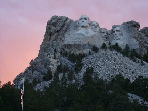
National Park Service – South Dakota: Offers information on national parks and historic sites within South Dakota, including camping options, park activities, and visitor guidelines. The site provides resources for planning visits to sites like Badlands National Park and Wind Cave National Park.
Black Hills National Forest – Camping & Cabins: Provides information on camping and cabin rental opportunities within the Black Hills National Forest, including campground details, amenities, and reservation procedures. Users can explore various sites suitable for tents, RVs, and group camping.
South Dakota Game, Fish, and Parks – Find a State Park: Features a directory of state parks and recreation areas across South Dakota, including information on camping facilities, activities, and amenities. Users can search for parks by region or activity to find suitable camping destinations.
South Dakota Game, Fish, and Parks – Campsites: Provides detailed information on campsites within South Dakota's state parks, including amenities, fees, and check-in/check-out times. Users can find guidelines for camping units and policies for shared sites.
South Dakota Game, Fish, and Parks – Campground Maps: Offers maps of campgrounds within South Dakota's state parks, including site layouts and facility locations. Users can utilize these resources for navigation and trip planning.
South Dakota Game, Fish, and Parks – Lodging Options: Details various lodging options available within South Dakota's state parks, including cabins, lodges, and other accommodations. Users can find information on amenities, availability, and reservation procedures.
South Dakota Game, Fish, and Parks – Contact Us: Provides contact information for South Dakota Game, Fish, and Parks, including phone numbers and email addresses for general inquiries and specific parks. Users can reach out for assistance or additional information regarding their camping plans.
South Dakota Game, Fish, and Parks – Rules and Regulations: Outlines the rules and regulations for camping within South Dakota's state parks, ensuring a safe and enjoyable experience for all visitors. Users can familiarize themselves with park policies, reservation procedures, and safety guidelines.