Fort Peck Project Camping
notifications Text me when there's a cancellation at Fort Peck Project


Fort Peck Project
Fort Peck Project
Fort Peck Project
Fort Peck Project
Fort Peck Project
Fort Peck Project
Fort Peck Project
Fort Peck Project
Fort Peck Project
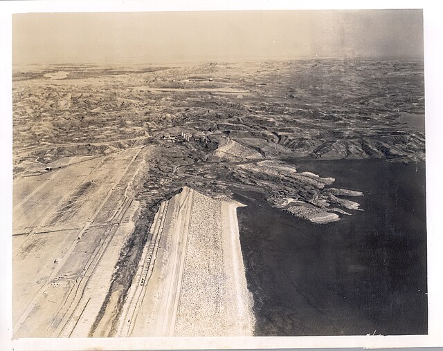
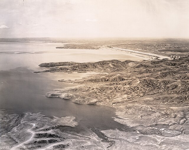
According to the World Almanac, Fort Peck Dam, MT is the largest embankment dam in the United States with the fifth-largest man-made reservoir. The vast size of Fort Peck Lake and its remoteness from major population centers provides a variety of high quality outdoor experiences including camping, boating, fishing, hunting, sightseeing, and wildlife viewing. This project has 19 recreation areas.
The Fort Peck Dam is the highest of six major dams along the Missouri River, located in northeast Montana in the United States, near Glasgow, and adjacent to the community of Fort Peck. At 21,026 feet (6,409 m) in length and over 250 feet (76 m) in height, it is the largest hydraulically filled dam in the United States, and creates Fort Peck Lake, the fifth largest artificial lake in the U.S., more than 130 miles (210 km) long, 200 feet (61 m) deep, and it has a 1,520-mile (2,450 km) shoreline which is longer than the state of California's coastline. It lies within the Charles M. Russell National Wildlife Refuge. The dam and the 134-mile-long (216 km) lake are owned and operated by the U.S. Army Corps of Engineers and exist for the purposes of hydroelectric power generation, flood control, and water quality management.
The dam presently has a nameplate capacity of 185.25 megawatts, divided among 5 generating units (which in turn are divided between the Western and Eastern grids). Three units in powerhouse number one, completed in 1951, have a capacity of 105 MW. Completed in 1961, the two remaining generating units in powerhouse number 2, have a nameplate capacity of 80 MW.
The lake has a maximum operating pool elevation of 2,250 feet (686 m) above mean sea level and a normal operating pool elevation of 2,246 feet (685 m) above mean sea level. The lake level fluctuates over time based on a number of factors. During the first week of February 2007, the reservoir set a record low elevation of 2,197 feet (670 m) above mean sea level, nearly 12 feet (3.7 m) lower than the previous record low set in 1991. In June 2011, in response to the 2011 Missouri River Floods, the dam was releasing almost 66,000 cubic feet per second (1,900 m3/s), which greatly exceeded its previous record release of 35,000 cu ft/s (990 m3/s) set in 1975.
We can help! Many campsite reservations are cancelled daily. Just tell us when you’d like to camp at Fort Peck Project, and how long you want to camp for. We’ll text you when a suitable spot opens up!
Scan for cancellationsWhoops! Sometimes we make mistakes. Want to help improve the Fort Peck Project listing? Please suggest a correction.

How was your visit to Fort Peck Project? Share your review of Fort Peck Project and help fellow nature-lovers make an informed decision.
Post a reviewTell us when, where, and how long you want to camp for. We’ll notify you (via SMS) when a suitable spot opens up at that campground—so you can nab that sold-out campsite reservation!